Wednesday, 29 January 2014

Doubtful Sound - Two Days Sea Kayaking in Fiordland NP

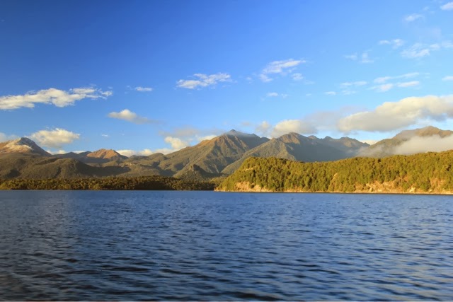
A sunny day, it seemed, to start our adventure in Fiordland NP. We took a ferry across Lake Manapouri followed by a short bus journey to reach Doubtful Sound; the remoteness of which fully delivered the sense of isolation we were hoping for.


On reaching the fiord (mistakenly named a 'sound') the weather became more typical of the west coast and the drizzle set in. It wasn't going to dampen our spirits, and instead added to the atmosphere.


This ancient glacial valley flooded by the sea (hence fiord, not sound, which is a river valley flooded by the sea) had steep cliffs rising dramatically from the water, with trees and mist clinging desperately to the rock.


Fresh water running down the cliffs in countless waterfalls, picks up dark tannins and sits above the denser salt water, creating a black oil-like surface. Below deep sea fish 'tricked' by the dark water move through the murk close to the surface.


Our experience kayaking in Canada served us well, allowing us to skim quickly over the mirrored water. It made a pleasant change to let our arms do the work and give our legs a well earned rest!


Our very remote campground was very much a 'wilderness' experience with stunning views and the calls of Kiwi birds throughout the (very dark) night.

We shared the camp with our lovely group of five other intrepid souls... unfortunately we also shared it with a plague of sandflies... one more bite and Dave would have needed a blood transfusion!


Up at the crack of dawn to witness the glassy water... still no rest-bite from the flies (pun intended) haha!


We paddled in the company of seals, two dolphins and a penguin, all adding to the sense of nature. Later, as the wind picked up we had to work hard to paddle against the swell.


As the weather deteriorated further, we headed back to civilisation with just one final glance back down from Wilmot Pass as the clouds closed in. Another incredible adventure in an unforgettable landscape!
Friday, 24 January 2014

Routeburn Track - 33km (20 miles) - three days - Great Walk 6/9

Day One: And so begins the journey to the start of our sixth Great Walk - from Queenstown we made our way along the shore of Lake Wakatipu to the Routeburn Shelter, where the trailhead of our tramp is located.


The Routeburn Track traverses a high alpine pass connecting Mt Aspiring NP and Fiordland NP. We stopped for a snack next to crystal clear glacial pools.


The first hut was situated on the flats, surrounded by high peaks. This was not our destination for the day, but a great place to brew a coffee and recharge for the climb to our overnight stop.


We got there as the heavens opened, and the deluge lasted all night. One brief respite allowed a quick glimpse of the impressive vista below. It was a chilly night in the hut as the temperature began to fall!


Day Two: With the tramp gaining so much altitude we were very soon up to the snow-line where yesterday's downpour had fallen as fresh snow. It was windy and cold but very much an adventure!


Can you believe this is the height of summer?


The temperature was well below freezing and in places we were walking through 5-6 inches of snow. Not exactly what we had bargained for on a summer hike!


Whenever the clouds parted the views were mesmerising. The addition of snow enhanced the beauty of the mountainous landscape. This view looked down upon Lake Mackenzie, the location of our hut.


After several hours in pretty much blizzard conditions, it was a relief to have our goal in sight.


As we wound our way down the mountainside we once again encountered the unique NZ bush, twisted moss-covered trees crowded the air making the atmosphere still & close!


Like a scene from 'Where the Wild Things Are' we half expected creatures to be lurking behind every turn... but it was only Dave!


Through the forest in one piece... we reached the peace & tranquility of the lake.


The misty light made a magical setting.


As the sun dropped, signs of the weather abating gave us hope for clearer views tomorrow.


Dusk provided encouragement for some experimental shots:


Day Three: The rain had ceased but there was still plenty of water around. We encountered many waterfalls that trickled and tumbled:


Finally some blue sky (very blue) and sunshine to warm us up. Hard to believe that just yesterday we were trudging through snow on the very same walk?


The outlook was incredible...


... the optional side trip to Key Summit was well worth the extra KM's.


Looking back down the valley over the route we had taken, it was unanimous, the Routeburn has leapt into first place as our favourite Great Walk. Next we tackle the famous Milford Track (described as the World's best walk). Expectations are high!!! :-)


Monday, 20 January 2014

Lake Wanaka & Rob Roy Glacier

Up at dawn to see in the new day; it was a cloudy (soon to be wet) one. The little, much photographed, tree in Lake Wanaka became the first focus of the snaps for the day.


It turned out to be a day of arts and crafts, due to the rain never letting up, but we got out in the early evening for a scenic stroll. The Diamond Lakes trail provided a great setting for the dimming light.


Looking out over Lake Wanaka we agreed that this is one of our favourite spots in NZ.


The following day, sunshine greeted us as we travelled on an unsealed road (very bumpy) to walk to Rob Roy Glacier Valley.


A gentle walk by our standards, but still some stunning views.


The 176m falls was a magnificent backdrop.


As we reached the trail-end the hanging ice stretched up above us. We had not seen so many waterfalls in one place, and it wasn't just the water that was falling; regularly large chunks of ice tumbled down the rock face... thunderous!


A super final day walk in the Wanaka area before we head to the Routeburn Track, our 6th Great Walk: a three day tramp beginning on Wednesday. We're forecast rain but hopefully we can update you with some photos of our next adventure?

Friday, 17 January 2014

Wanaka & Mt. Roy's Peak

Wanaka is a little town situated on the bank of a deep blue lake, surrounded by rugged mountains. A beautiful place to rest up after our hard walks in Mt. Cook! However, we'd been told of a hike up to Roy's peak that's not to be missed... so you've guessed it we strapped on the walking boots and headed to the hills!


The gradient was more gentle than our recent walks, but with a 1578m accent over 16km's, it was still enough to get a sweat on!


Almost immediately we were rewarded with panoramic views over the lake.


Rounding the ridge we were greeted with views of Mt. Aspiring and surrounding peaks far off into the distance.


But this wasn't the top!


A narrow ridge climbed steadily to the true summit...


... we had really gained some elevation!


Dave sat/perched on a rocky outcrop to admire the Southern Alps with the route we had taken clearly winding its way beneath him.


The wind on the top was a bit fresh, luckily we had brought our jackets & gloves.


The town of Wanaka stretched out far below us as clouds cast strange shadows upon the lake.


A friendly German couple were on hand to take a snap of us (we've met more German people in NZ than we did in Germany).


An outstanding walk with spectacular views of a lovely setting. Wanaka is the place to be!


The way down felt a long way (it was a long way) and we had a few breaks. Maybe we will now finally have some rest time... but we doubt it!!!